Digitally enabling a shared understanding of place
Welwyn Hatfield Place Portrait
Hertfordshire, UK
Welwyn Hatfield, Hertfordshire is an area known for its mix of historic sites, new towns, and picturesque villages. The borough is also well connected, sitting just to the north of Greater London. With these assets comes an increasing demand to deliver new homes, jobs and services, whilst ensuring that any growth is socially, economically, and environmentally sustainable. These aspirations are captured as part of the Welwyn Hatfield Local Plan, a roadmap for the future which provides the basis for what, where and when development can happen.
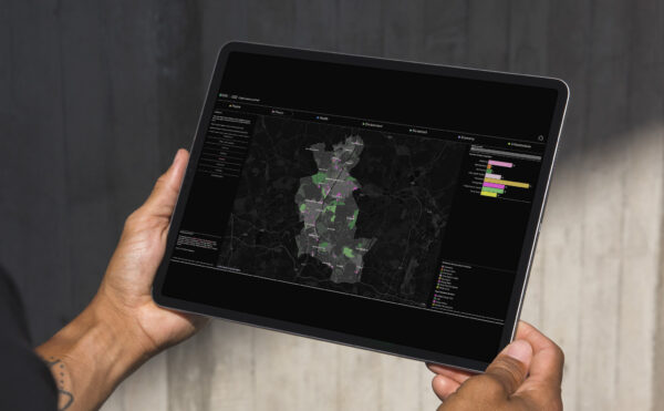
The adopted Local Plan is currently being updated by the Council, a process which requires a comprehensive understanding of Welwyn Hatfield and its current and projected needs. To support this, Prior + Partners’ team of data scientists, web developers and planners have developed the Place Portrait, an innovative digital tool which clearly and intuitively presents the region today, and crucially, goes further to demonstrate how we can turn this understanding into strategy, action, and positive impact for generations to come.
Digitally democratising data
The Place Portrait collates data from across multiple organisations including ONS, Natural England, Historic England, Ordnance Survey, OHID as well as locally held council data. Ordinarily such fragmented data sources exist in silos with have no centralised repository, and many datasets are not formatted or spatialised, making it difficult for users to explore, organise, and interrogate them intuitively and wholistically. It also requires knowledge of basic Geographic Information Systems (GIS), data and statistics, a skillset often lacking in local authorities.
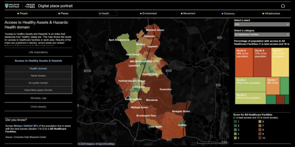
Recognising this absence of easily accessible and accurate shared data, our Place Portrait seamlessly integrates over 95 key datasets to create a digital evidence base. Achieving this has required extensive digitisation, standardisation, processing and analysing to ensure all datasets are consistent, usable, and presented in an understandable format. The output is more than 60 dynamic dashboards, including environmental, demographic, socioeconomic, mobility and health & wellbeing data to understand trends and patterns across the whole region.
Unlocking new insights
The Place Portrait unlocks new insights on Welwyn Hatfield at a strategic and local scale, including physical datasets such as the distribution of flood risk, environmental designation and heritage, as well as community focussed data like the latest census results, the Indices of Multiple Deprivation and travel to work trends. Advanced analysis also reveals previously hidden patterns and allows us to break down complex problems into clear and measurable quantitative metrics that capture the existing performance at a hyper-local scale.
For example:
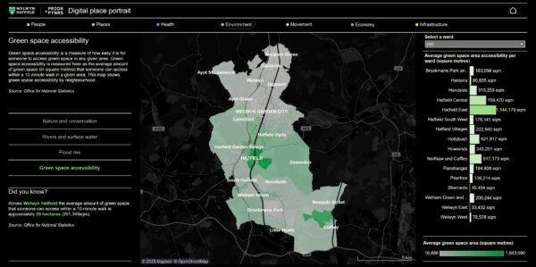
- How many open spaces are accessible to residents within a 10-minute walk?
- How many health facilities can be accessed within a 10-minute walk?
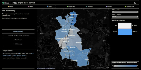
- What is the average life-span of residents, and how does this relate to race, sex, and access to health facilities and open space?
- What parts of the street network have the potential to be developed as public transport corridors?
Benchmarking place performance
Pivotally, regional and national benchmarks are also integrated into the Place Portrait, without which it would be difficult to grasp the significance of individual statistics alone.
Through understanding these opportunities and challenges, we can propose targeted, specific solutions and measure the outcomes of these, before they are planned and built. For example, where would a new health centre be best located, and where should we prioritise the delivery of open space.

A foundation for confident and efficient decision-making
With datasets now digitised, spatialised and processed into a user-focused, interactive digital platform, we have broken down barriers to accessing and understanding previously siloed datasets. This approach enables the Council, stakeholders and communities to intuitively visualise Welwyn Hatfield’s characteristics, enhancing communication and understanding.
Critically, the Place Portrait acts as a ‘single source of truth’, paving the way for more informed and evidenced decision-making, ensuring Welwyn Hatfield’s future is shaped not by chance, but by a clear, shared understanding of place.
In the future, the Welwyn Hatfield Place Portrait’s modular and flexible design will enable easy and efficient data updates as well as new maps, tools, and features to be integrated. This adaptability ensures it can remain a dynamic, data-driven resource – empowering planners, policy makers, and communities to shape sustainable inclusive growth.
The full Place Portrait for Welwyn Hatfield can be accessed here.


